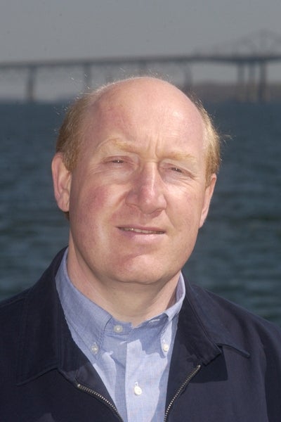
KINGSTON, R.I., July 12, 2016—Hurricane season is upon us, and thanks to a University of Rhode Island scientist we’ll know more about what to expect when the winds howl.
Isaac Ginis, an internationally renowned hurricane expert, was the first scientist to show the role the ocean plays in the path and intensity of hurricanes.
Improvements made by Ginis and his colleagues for the 2016 season will make the models even more accurate. The National Weather Service upgraded its operational hurricane prediction models—the Geophysical Fluid Dynamics Laboratory (GFDL) and Hurricane Weather Research and Forecasting (HWRF)—on July 12.
The upgrades will help track storms in the Northern Hemisphere basins, including the Central Northern Pacific, Western North Pacific and North Indian Ocean.
“Water temperature is the most important factor in forecasting hurricane intensity,” Ginis says. “Hurricanes draw heat from the ocean and they need high water temperature to develop.’’
Hurricane force winds create ocean currents that cause warm surface waters and cooler subsurface waters to mix, leaving a wake of cool water at the surface, he says. The cool wake moderates the intensity.
One of the most significant challenges for the forecasters is to predict hurricanes that intensify rapidly. Hurricane Patricia, which influenced the eastern North Pacific in 2015, intensified by an astonishing 105 knots from a Category 1 to a Category 5 during a 24-hour period, says Ginis.
For the 2016 season upgrades, the URI scientists have implemented into the HWRF and GFDL models a new procedure for more realistic ocean conditions to improve forecasts.
[pullquote]“Water temperature is the most important factor in forecasting hurricane intensity,” Ginis says.[/pullquote]Remarkably, Ginis and his URI colleagues are already planning improvements to the HWRF model for the 2017 season. These improvements will factor in waves on hurricane prediction.
“Hurricanes are known to generate strong surface waves,’’ says Ginis. “These waves create friction or drag, which slows the surface winds in hurricanes. Accurate predictions of hurricane track and intensity require knowledge of spatial and temporal development of the waves and the surface drag they produce. Surface waves also affect the ocean cooling underneath the hurricane.’’
Ginis’ research is groundbreaking. He uses data collected from aircraft, satellites and ocean buoys to significantly improve hurricane predictions throughout the world. The hurricane season is generally from June 1 to Nov. 30, with a peak in late August and early September.
His work involves modeling that requires high-performance computing, but almost all of his computing is done at the U.S. Navy, National Oceanic and Atmospheric Administration and other universities. That group includes the University of North Carolina at Chapel Hill, which has been named a national Center of Excellence by the U.S. Department of Homeland Security to research coastal resilience.
The National Oceanic and Atmospheric Administration Hurricane Forecast Improvement Program has supported URI’s research.
“For the last 15 years, NOAA has worked closely with Professor Ginis and his group to improve the National Weather Service’s operational hurricane models,’’ says Morris Bender, senior research scientist at NOAA. “His work has been critical to improve intensity prediction by pioneering how the ocean and the atmosphere interact, and how the hurricane derives its energy from the ocean surface.’’

