NARRAGANSETT, R.I., Oct. 9, 2018 — A new analysis of ocean regions around the world shows that bottom trawling, which accounts for a quarter of the world’s seafood harvest and can negatively affect marine ecosystems, occurs on just 14 percent of the seafloor along continental shelves and slopes. These findings indicate that the footprint often had been overestimated significantly.
The analysis, which examined high-resolution data from 24 ocean regions off Africa, Europe, North and South America and Australasia, is the result of research by nearly five dozen scientists from 22 countries, including Jeremy Collie of the University of Rhode Island’s Graduate School of Oceanography.
The findings were published Oct. 8 in the Proceedings of the National Academy of Sciences. Lead authors are Ricardo Amoroso, who completed the research as a University of Washington postdoctoral researcher in the School of Aquatic and Fishery Sciences, and Simon Jennings of the International Council for the Exploration of the Sea.
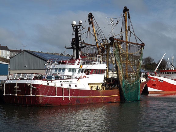
The researchers examined satellite monitoring and fishing logbook data from 7.8 million square kilometers of seafloor shallower than 1,000 meters (3,280 feet), the regions where most of this type of fishing occurs. Bottom trawling involves dragging a net or dredge along the seafloor of the continental shelves and slopes to scoop up shrimp, cod, rockfish, sole and other bottom-dwelling fish and shellfish. The technique impacts ecosystems because other marine life and habitats can be killed or disturbed unintentionally as nets sweep the seafloor.
Until now, scientists had been unable to determine with precision how much of the seafloor, called the footprint, is trawled worldwide.
“Trawling is a controversial fishing method, and until now its footprint has not been quantified in many ocean regions at resolutions that impart confidence. Now, using this high-resolution data, which examines the seafloor in finer increments, we were able to determine that the extent of trawling activity is actually less extensive than previous measurements would indicate,” said lead author Ricardo Amoroso.
Earlier analyses mapped trawling on 1,000 or more square-kilometer grids, for example, compared with the 1- to 3-square-kilometer grids used in this analysis. Footprint estimates presented in the new study also are more accurate than some previous ones because they incorporate information about fishing gear used, the authors said. Knowing whether a trawling net spans 10 meters or 100 meters, for example, helps to improve the estimate of the seafloor area impacted.
While the authors found that 14 percent of the regions included in the study were trawled, there were major regional differences. For example, only 0.4 percent of the seafloor off South Chile is trawled, compared to more than 80 percent of the seafloor in the Adriatic Sea — a part of the Mediterranean Sea found to have the most intense footprint.
“The results of this study are very relevant to the New England region, where bottom trawls and dredges remain important fishing gears. Although data from New England were not used in the study, similar spatial data are used to designate closed areas to protect benthic habitats,” added co-author Collie. “We expect the bottom-trawling footprint to have diminished as the fisheries have been more highly regulated, providing an ancillary environmental benefit.”
The authors acknowledge that other regions known to have intense trawling activity were not included in this study because data providing a complete picture of fishing activity were not available. Southeast Asia is one of those regions.
Still, the paper offers the most comprehensive look yet at trawling activity worldwide. It also describes a way to estimate footprints from trawling in regions where gear dimensions, vessel speeds and total hours trawled are known, but that lack the vessel-specific spatial tracking now collected by some fleets.
The study was funded primarily by the David and Lucile Packard Foundation and the Walton Family Foundation.
URI’s Narragansett Bay Campus is home to the URI Graduate School of Oceanography (GSO), one of the world’s premier oceanographic institutions. Founded in 1961, GSO has built a reputation for excellence in deep water oceanographic research, coastal planning and management, sustainable fisheries and monitoring the health of Narragansett Bay. With operations, researchers, faculty and students worldwide, the Bay Campus education and outreach programs train the next generation of scientists and policymakers, while ensuring Rhode Island’s K-12 teachers and students gain an appreciation for the importance of ocean science through a variety of hands-on programs.
On Nov. 6, Rhode Islanders will vote on Question 2, a $70 million higher education general obligation bond that includes $45 million for upgrades to the Narragansett Bay Campus. If approved, proceeds from the bond will be used to improve the GSO’s pier (required to accommodate a newly awarded Regional Class Research Vessel from the National Science Foundation worth about $125 million), construct a 20,000-square-foot Ocean Technology building, a Marine Operations building and fund other necessary improvements to campus facilities.